Wednesday, November 5, 2014

Day 2-355 back HOME -that says it all...

     We departed the Galveston Yacht Basin at about 7:00 am in 15-18 mph winds with gust of 25+ out of the northeast. Our trip to League City was 28.7 miles with about 2/3 of that in the Houston Ship Channel. These conditions are within our comfort zone, but in retrospect, we should have waited until later in the afternoon when the winds had died down to about 5-8 mph. However, hind sight is always 20/20. The ship channel at Galveston runs east-west between Galveston Island and Pelican Island to the north. Thus, we had been underway about 15 minutes before we rounded the corner of Pelican Island and could feel the true effect of the wind. The AIS had at least 30 vessels plotted in our general area. Fortunately, at least half of those were tows "parked" along the GICW waiting for the winds to die down before they headed up the ship channel to Houston.  It takes about another half hour to pass the GICW crossing and the turn off to Texas City. At that point all of the turning and cross traffic is behind you, and we could settle into the routine of staying out of the way of the commercial traffic in the Houston Ship Channel.
      We passed three ships coming toward us in the sip channel as well as about 6 tows. That is the easy part since on a clear day, you can see them coming for many miles and have plenty of time to move over to the side of the channel. The picture at the right shows the Ocean Aquarious about to pass as she heads out the ship channel. I said that you have plenty of warning with approaching ships, but I did not say that one is ever prepared for how big they are or how fast they are going. In this case we were closing at about 30 mph...

      The picture at the left shows the outbound HS Carmen about to pass. Both of these pictures give you a good idea of the waves. Although we were inside the channel markers, we were pretty much at the red markers on the east or in bound side. Generally, we record about 26 feet of water in the channel, but along the sides it gets shallow very quickly. I'm not sure what the average depth of Galveston Bay is, but we rarely see more than about 12 feet of depth minus 4 feet for our draft. So, with shallow water the waves cannot get very high, but they can be steep and close together.

     Okay, so ships and tows coming toward you are easy to see in clear day light, but as the skipper, I need to keep a lookout for ships coming up astern of us. This is a necessity since they are closing from behind at over 25 mph and can "sneak" up on you if you are not careful... Fortunately, the Admiral is much better at checking astern than I am, which helps a lot. The picture at the right shows the Nordic Ann about to pass us. She is going into the wind, and you can see the spray flying in continuous sheets  15 to 20 feet in the air.


      There are a number of places where we could leave the ship channel and head for the entrance to Clear Lake at Kemah, Texas. We chose to say in the ship channel until we could turn and have the wind almost directly from the stern. After the turn, we noticed that the dingy had partially torn loose and was about to fall off its davit on the swim platform. We slowed down and were able to pull her partially back on board (picture at left), and thanks to the Admiral we secured her with several dock lines. Not a perfect fix, but it was good enough until we reached our dock. The photo may look strange since it was taken from the flybridge looking down at the dingy.
      Earlier we had heard an announcement by the Coast Guard that the Lakewood Yacht Club was having sailboat races just off the Kemah Channel starting at 10:00 am. So, we wove our way through about 40 sailboats as we headed into the Kemah Channel.  Fortunately we made it into the channel before the racing started (picture at right). There is a power boat headed out the channel, and in the background you can see some of the amusement park, including the roller coaster (at left) and several rides that go in loops or drop you from tall towers. On the far right there is a sailboat just exiting the channel that connects Galveston Bay to Clear Lake.
      Our destination is at the far (western) end of Clear Lake about 4 miles from the spot where this picture was taken. Most of Clear Lake seems to be no more than 6 feet deep so we need to stay in the marked channel if we want to speed up to normal cruising speed. The picture at the left shows our view as we turned into the channel to South Shore Harbor. Yup, it is definitely not a great picture since we were headed right into the Sun, BUT at this point we could see our town house on the left and the lighthouse on the right which we can see from any of 4 rooms on the back side of the town house.
     Pretty soon we were opposite our town house, and the slip for Lucky Us is just out of the view to the right.

     To be honest, the next little while was all a blur as we docked and walked the short distance to the town house.

   Yes, it was a great feeling to be home, but...


     Anyway, here is the final picture (at left), and it shows Lucky Us sitting happily in her slip probably wondering where we are going to take her next???

Day 2-354 to Galveston, TX - Almost home!

     It was not a long trip to Galveston (64.2 miles), but especially with shorter days this time of the year, it would really have been too long a day to have gone all of the way home today. We will save the next 28.7 miles for tomorrow... Of course, we did start the day at sunrise as the time stamp of 7:31 am on the photo at the right indicates. There is some good news here since in two more days we will lose Daylight Savings Time, and then this picture would have been taken at 6:33 am... Somehow that knowledge does not really make me feel any better. A sunrise departure is still too early! We were anchored about 1 mile off the waterway up the channel in the foreground. There were as many as three tows anchored to the north (left in the photo) of us during the night and one anchored to the right. As luck would have it, two of the four tows decided to leave at sunrise also.
     The Gulf Intra Coastal Waterway and these side channels all seem to have good holding for our CRQ plow anchor. The mud is black (i.e. has a high content of organic matter), and as a result, the smelly mud needs to be washed off the anchor chain before it goes into the chain/rope locker under the windlass. The picture at the left shows the Admiral hosing down the chain to wash off the mud. As you can see in the photo, the Admiral is warmly dressed for the cool morning air (about 58F). Our "official" start time was 7:39 am when the anchor was locked into place.

      In the early morning air, we saw some unusual sights, such the feral hogs along the bank in the picture at the right. One of the things that we have both loved about this trip is that every time you think you have seen it all then you see something new or different.


     Continuing on the theme of new and/or different, we also saw these two "Texas Canaries" along the shore. Of course, these canaries sing something that sounds more like "hee haw" or whatever it is that donkeys really sound like. They seemed to take no notice as we passed by them while they munched on the grass.


      We also had a visitor on the bow rail for a few minutes. Of course, we have seen many birds, but this is the first one that I remember seeing land while under way and stay. Clearly, we were not a port of refuge for the bird since we were only a few hundred feet from shore... Still it was a day for strange sightings given that this is Day 2-354 and these are not exactly exotic animals.

      We continued to see many tows again today. The picture at the left shows a deck barge loaded with "stuff" headed for a new refinery near Lake Charles (?). This is the second tow headed east that we passed loaded with towers like this. According to the chatter on the radio, this tow is headed for a new terminal near Lake Charles.
     We also passed 7 tows headed in our direction. Several of the tows, like this one, looked like they had just been repainted. We always try to wave at the operators, and if we are passing one, we always try to thank them on the radio. Today must have been a good day in general for them since they were very chatty on the VHF radio.


     We also  went by a pelican convention that was taking place on a narrow spit of dredge spoil along the north side of the channel (picture at left). The white and brown pelicans were really packed together tightly. We do not usually see many white pelicans around Galveston Bay during the winter so maybe the white pelicans are headed west and south along the coast. At this point we were travelling along the southern boundary of Galveston Bay. The tows in the background are actually in the Houston Ship Channel in Galveston Bay. For reference, The Bolivar peninsula is behind us in the picture, and it actually forms a physical barrier separating the Gulf of Mexico from Galveston Bay. The Bolivar Peninsula is generally very low and narrow. It is (or was) a popular area for summer cottages, but it was heavily damaged when the storm surge from Hurricane Ike swept over the peninsula in 2008.
      The Houston Ship Channel goes between the western end of the Bolivar Peninsula and Galveston Island. The two white buildings and the black lighthouse are what is called the Bolivar Lighthouse. The lighthouse is a classic 19th Century cast iron lighthouse that was made in Pittsburgh, PA and shipped here by barge down the Ohio and Mississippi Rivers.
      The traffic really picked up as we approached the Houston Ship Channel (picture at left). The Houston Ship Channel is the second busiest in the World, and the "intersection" where it crosses the Gulf Intra Coastal Waterway is just bonkers. There are tows going into and out of the ship channel as well as tows crossing and ship channel. Within a mile or so both north and south there are other channels that lead into Galveston and into Texas City. Throw in numerous shrimp boats and between 3 and 5 large car ferries that run from Bolivar Peninsula to Galveston. Well, you get the picture. It is a very busy stretch of water...
     We docked at the Galveston Yacht Basin without any problems, and we managed some time to relax. Our friend, Debbie S., picked us up to take us to historic downtown Galveston for dinner (picture at left). We had great seafood and got caught up over dinner. Debbie dropped us off back at Lucky Us about 9:00 pm, and that was it for the day...

Tuesday, November 4, 2014

Day 2-353 Back in Texas, back in Texas, back in.... Whoop!


      Today we had a short but busy 61.1 mile trip to an anchorage just south of Port Arthur, TX. The first 10 miles took us back down the Lake Charles Ship Channel to the waterway. The L'Auberge Casino is on the south side of Port Arthur so we only went past about half of the refineries,  and cargo terminals, etc. Never the less, I started a running count of "vessels". We also went through part of the ports at Beaumont and Port Arthur. Altogether we passed by 16 harbor tugs, which are used to help ocean going tankers and cargo ships dock and maneuver, 3 ocean going tug-barge combos, 9 ocean going tankers or cargo ships and nearly 100 tows (towboats with one or more barges) and 6 lite tows (towboats with no barges). In Lake Charles we saw several of the relatively new style "tractor tugs". In map or top view these tugs (picture above) have an elliptical (or egg) shape, and the drive unit with the propeller rotates 360 degrees, which makes them extremely maneuverable.  In the count I attempted to avoid any vessel that appeared to be abandoned (and there are a number of vessels that hopefully will be scrapped soon).

Speaking of cutting up boats for scrap, we passed a row of oil storage tanks mounted on flat deck barges that were being cut up for scrap. It was truly a busy traffic day. We passed 8 tows going in our direction, which altogether took about 2 hours of our travel day. By the way our travel day lasted about 7.5 hours. We left our dock at the casino at 8:05 am and arrived at our anchorage at 3:45 pm.
     Once we reached the waterway and turned west to head for Texas, we could see a large backlog of east bound tows that were waiting for the Calcaseau Lock just to the east. This is the same lock that we had passed through late yesterday, and it is closed daily from 7:00 am until 5:00 pm. This picture was taken at about 9:00 am, and it looks like there will be a huge traffic jam in another 8 hours when the lock re-opens...
     Once we left the Lake Charles Ship Channel and turn west in the waterway, we resumed making positive progress toward the Texas-Louisiana state line. I guess that we were missed by our friends in Texas since someone kindly erected this huge bill board on the state line ha, ha... Well, minus the sign that I had pasted in using PowerPoint, this is pretty much what it looked like as we crossed the state line. Miles and miles of coastal marsh...
     When you approach Beaumont from the east, the waterway joins the ship channel on the south side of Beaumont. The ship channel continues on north under these bridges into the center of town. As you can see, this is a very busy intersection.


     Just before (east of) this intersection, at least one company has a major staging areas for tows, tow boats and barges. There were big and little tow boats moving everywhere. When I said earlier that we had passed a lot of (active) traffic today, I really was not kidding.
     Another interesting sight was this ocean going tug in a floating dry dock for repairs. You can see the large steel cylinders that surround and protect the propellers. Obviously, the protection is not perfect since both propellers and drive shafts have been removed for repairs (?). This huge tug fits into a large notch at the stern of ocean going barges that are shaped more like small ships. There is a man in the picture for scale so that you can get an idea of the size of the propellers, etc.
      The cities of Beaumont and Port Arthur are seemingly joined at least along the waterway/ship channel. The area along the shore is protected by a high (?) dike (picture at left). It is a strange sight because you can see a lot of roofs looking over the dike, but there are very few two story houses that therefore have a chance of a view.
      It was in Port Arthur that we actually passed alongside 3 ocean going cargo ships (picture at right). Most of the dry cargo ships that we have seen along the Gulf Coast were being loaded with coal (and some with grain).


      I included this picture of the bow of an empty ocean going freighter since you get a good view of the bulb on the bow below the water line. The bulb serves to reduce the effect of approaching waves and to increase speed. Below the level of the anchors, you can see the international signs for a bulbous bow and a bow thruster, which is below the waterline even when the ship is empty.
      On the south side of Port Arthur the waterway turns off the ship channel and heads west along the coast. The ship channel continues south to the Gulf of Mexico. It was in this are that we saw several large fleets of Gulf shrimp boats. They are much larger that the coastal boats that make short one day trips. These larger boats range further out into the Gulf Of Mexico on multi-day trips.


      Once the waterway turns off and heads west we went under a high fixed highway bridge, dodged a bunch of tows and this dredge. There is also a refinery in the background. Very soon we reached our turn off into a man made channel that goes to the north. The channel seems to serve no purpose, but it does head along the back (or west) side of the refinery in the picture. There were three tows "parked" in this side channel as well as a lot of long floating pipes for the dredge. We go about a mile up this side channel to a wide place where we can anchor and swing completely around without hitting anything during changing tides or winds. Then we had dinner and were about to settle in for a quiet evening when I remembered that half of the 360 degree white anchor light did not work. The  anchor light is the highest point on the boat, and it contains two white (or clear) bulbs. The reason for the two bulbs is that the forward facing bulb is also turned on with the running or navigation lights. With the Admiral's help I removed the screws that hold a two foot long pipe that elevated the light fixture above the radar. To do this I had to stand on top of three seat cushions on top of a fiberglass storage chest. It was a pretty shaky set up at best, but fortunately the Admiral held me steady. Then of course, we discovered that the replacement bulbs that we had were about a 1/4 inch to long to fit into the snap in socket... Well, boaters are and have to be resourceful... I ended up using ordinary cotton string to tightly tie the bulb into place as best that I could. It worked, and in fact the light was still burning brightly the next morning. Not exactly the kind of repair that would pass a rigorous (official) inspection, but we were lighted as required while at anchor for the night.

Monday, November 3, 2014

Day 2-351 to 352 At L'Auberge Casino & Resort in Lake Charles, LA

     After a long day yesterday, we decided to stay here at L'Auberge for 3 nights (i.e. 2 full days) to rest up a bit before the final 3 days "push" to get back home. When we "crossed our wake" and closed the Loop on Mobile Bay that was fun and a feeling of accomplishment. However, neither of us really knows how it will feel when we arrive home, and our trip/adventure is really over... As always, time will tell.

Day 2-351
      Boy, it felt great being able to sleep in and not seeing the sun rise. We went to the buffet at the hotel for lunch. I did pretty good on portion control until I got to the desserts... Then, since the buffet was adjacent to the casino, the Admiral decided to take her second plunge at the electronic roulette. It turns out that after her morning walk, she had been magically "drawn" into the casino. Her second adventure was quite successful. So much so that when she cashed out, she was up $3.00 for the day... Rumor has it that each of the three Grandkids is going to get a share of her winnings. Then it was my turn, as I got a delightful nap on board Lucky Us.
     In the late afternoon we got the bikes out and headed to the new shopping district about a mile away. It is quite a pretty ride along a beautifully landscaped parkway with a golf course along one side. We made a brief, unsuccessful stop at Target, and then we started to look around for possible dinner places. After we rode by several different restaurants, the Admiral suddenly said "follow me". Yes, we had dinner at the Sonic Drive In, and in the picture at the right the Admiral is placing our order. They have a small area with picnic tables and of course, the sign where you place your order. I had a burger with tater tots and a very tasty (diet) cherry limeade. It was perhaps a little off beat but a fun experience.
     Then on the way back to Lucky Us we headed to Sam's Club for some staples like salad mix, bananas, and ice cream.

     The ride back to the casino was very pretty as the sun was starting to set. The picture at the left shows the beautiful sunset over the beach at L'Auberge just after we had loaded the bikes back aboard Lucky Us.

     Then we settled in for a "typical" evening of TV and blogging. As usual, the evening ended early...


Day 2-352
     Wow, I could get used to sleeping in, but being a realist, I know that we will be heading out tomorrow morning for an anchorage just south of Port Arthur, Texas. Today was even more hanging out on the boat. We had the seals on both rudder shafts repacked before we started the Loop, but the packing nuts needed to be tightened. The packing on the propeller and rudder shafts consists of waxed thread that is woven into a square "rope" that wraps around the shaft. There is a packing nut that is compressed by either large nuts (on the propeller shafts) or a cast brass fitting (rudder shafts) that is compressed by bolts on opposite sides. As the packing is compressed (squeezed), it expands outward to seal the gap around the shafts. It is very old technology, but it both seals the shaft to keep water out of the boat, and it is also a relatively low friction seal. After about 7,600 miles, the rudder packings were worn enough that water was coming into the boat at a rate of more or less constant drips. The seals needed to be tightened enough to slow that rate to a drop "or two" per minute. It is a pretty easy job, except for the contortions involved getting into a prone position down near the bottom of the hull inside the lazarette. Fortunately, the Admiral was able to hand me the wrenches and a flashlight once I had squeezed into position. Once again, some of the muscles involved were a little"reluctant" to make some of the contortions involved. Well, I survived, and the flow of water was once again down to acceptable levels. One of those general maintenance tasks that I probably should have done earlier, but it also means that the bilge pumps will have to work less often.
      We had lunch on board Lucky Us, but for dinner we went back to the Jack Daniel's Restaurant (and sports bar). At the end of the ramp that leads from the floating docks up to the casino and hotel, there is this classic sign (picture at left). I had seen the sign before during our two other stops here. This time I actually read the city names... It was pretty cool to think about how many of these places we had actually been during our Great Loop adventure. Also, we will be passing through Beaumont tomorrow, and Houston is just a few miles north of our final destination of League City, Texas.

     After dinner, we went across the way to the casino for one last "visit". They don't miss a beat since as you exit the restaurant, there just happens to be an entrance to the casino about 20 feet away. This time, in an uncharacteristically crazy moment, I even tried my luck at roulette. The craziness only lasted about 3 minutes until I had lost all of the money that I cared to lose... Even the Admiral was less than successful this time. Oh well, we will be back here again no doubt!
     Well, it has been another fun stay at L'Auberge. There are not a lot of pictures, since they are definitely NOT encouraged at any casino. You have probably heard the old saying that "what happens in Vegas, stays in Vegas". That saying includes photographs for a lot of reasons, from crazy behavior to the fact that not every one here is married (or at least to the person that they are with), etc.

   Time to hit the sack before another early start tomorrow.

Thursday, October 30, 2014

Day 2-350 to Lake Charles and L'Auberge Casino

           "Honey, I think that we should get started about 5:30 am tomorrow." Trust me that these are scary words, but tomorrow is a difficult day as far as scheduling goes. We have a bridge closed from 3-5:00 pm and a lock closure for construction from 7:00 am to 5:00 pm to deal with in a day where we hope to travel 91.9 miles. It is an ambitious schedule, but we had several "back up" anchorages in case the "best case" scenario did not work. The worst case scenario was that we would be delayed and anchor out. The best case scenario was that we would be playing slot machines at L'Auberge Casino and Resort in Lake Charles. Somehow we both managed to sleep well in spite of thoughts of juggling schedules to adjust for possible or real delays....
     We departed the fuel dock/marina at Intracoastal City at 5:30 am. This was an hour or so before sunrise, and you can consider yourself lucky that I did not insert a blank/black slide to show the sky... We had a short 3.4 mile trip to the Leland Bowman Lock. There was some light most of the way from several businesses along the waterway, but there was also a (very low) patchy fog. On the flybridge we were basically above the fog and could see the banks of the waterway through the darkness. Well, going slowly with aid of the chartplotter, AIS and radar, we felt safe. We arrived at the lock, which is a lock designed to prevent salt water intrusion into coastal (fresh water) marsh lands. As we arrived, the gate opened, and we crept forward slowly as the gate closed behind us. Then, almost immediately, the gate in front of us opened. Thus, we never really stopped moving nor did we have to tie up. So, we cleared the lock at 6:09 am, and at that point we were still good to go for our most optimistic day.
     At that point we had 68.1 miles to go in 9 hours to get to a pontoon bridge before it closed at 3:00 pm for 2 hours. However, it was still dark with some scattered fog so progress remained slow. By about 7:30 am the fog had mostly burned off, and we were able to go at our normal cruising speed. A quick calculation showed that if we had no prolonged adverse tidal currents that we should reach the pontoon bridge about 2:30 pm.
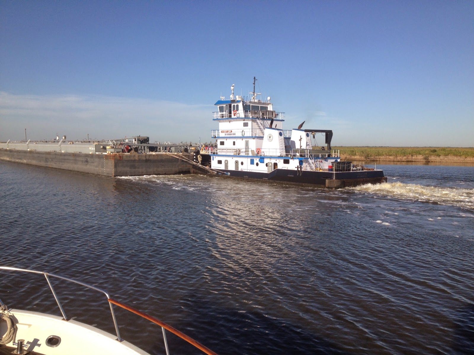
      It was about at this point that we learned another new towboat term. The picture at the right shows at towboat with a hydraulic helm station that goes up/down depending upon the height of the barge. We have seen plenty of these, but we had never heard them referred to as a "jack up" towboat. I hope that this little tidbit of knowledge totally makes your day (ha, ha).
     At this point, the Admiral took the controls so that I could take a nap. It had been a busy and somewhat tense trip so far, but I managed a nice 1.5 hours of sleep. We managed to keep our average speed at just over 8 mph in spite of some adverse as well as friendly currents.
      We did not have a lot of time to take pictures today since we were pretty busy. However, I did get another photo of a "spool" on a barge. ha ah.


      Along the Gulf Coast, the tows "chat" on VHF channel 13, and you talk with locks and bridges on channel 14. Everyone is also required by law to monitor channel 16, which is the official distress channel. It is easy to set the VHF to scan all three channels, but then you hear almost constant chatter on the radio. Trust me that I have more than once considered just shutting it all off for some peace and quiet, but...

     We reached the Grand Lake Bridge at about 2:30 pm and passed through with no delay. It was one of the classic bridges which is really a barge that is hinged on one corner. Cables pull the bridge open and closed. It is a fascinating operation to watch. There used to be quite a few of these in Texas, but more of them are replaced by high, fixed bridges every year. No doubt the local residents appreciate not having the (5 or 10 minute) delays, and I am sure that there is a certain safety factor in the case of emergencies. However, for the sake of progress, we are losing a bit of history ever time that one of these is replaced.
     Now, after clearing the pontoon bridge, the last real obstacle is the lock closure. We arrived at the Calcaseau Lock at about 3:00 pm, which was two hours before the lock was supposed to open. We had been passing a few east bound tows, but we did not think too much about it. Tows often pull into the bank for rest periods, etc. However, when we arrived at the lock, there was no line. There was one west bound tow in the lock ahead of us. However, we were "next" in line. It turns out that the repairs involved replacing "bumper boards" on the approach wall into the lock. Tows are often blown about as they attempt to ease into the lock. The lock walls outside on the approach are designed to funnel the tow into the lock. Evidently, the boards are designed to be somewhat sacrificial, which means that after enough of them get broken, they must be replaced. Today, the workmen on our approach side were working on the top two rows, and they were standing on top of the walls to do this. For boards lower down, they need to work from a barge, and the barge blocks the lock entrance. So, "Lucky Us" as the boat name implies. We were able to transit the lock without even tying up.

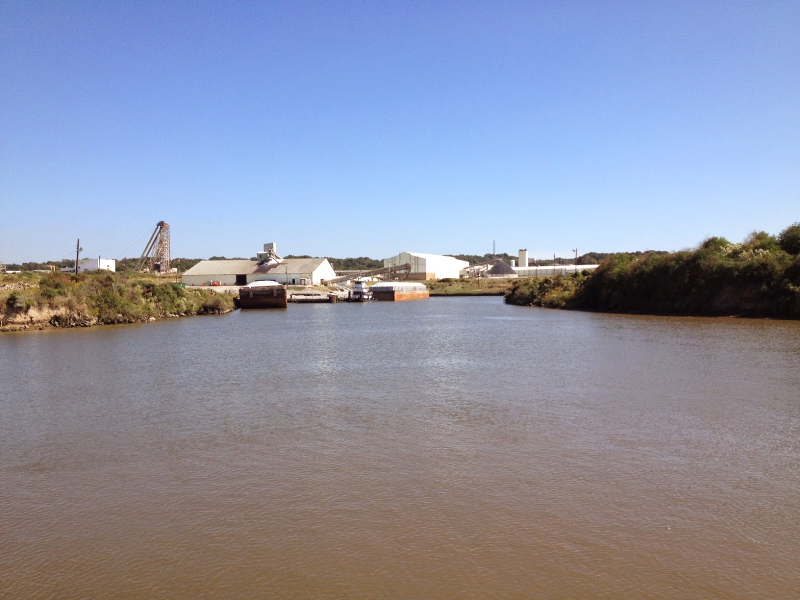
       The picture at the right shows the tows that were lined up at the other side of the lock. This is more like what we had been expecting when we had arrived at the other (east) side of the lock.

     So we thanked our lucky stars and proceeded on for 12 miles to Lake Charles, LA.

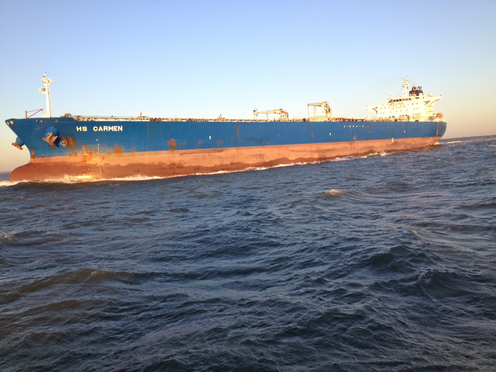
     Lake Charles is another very busy oil port on the Gulf Coast. The picture at the left shows one of several tankers that we passed on the way to Lake Charles.


      There are also several refineries that we go past, and there are more just up river and closer to the city of Lake Charles.


     When we stayed in Lake Charles on our way east to start the Loop, there was a lot of construction going on next door to the L'Auberge Casino where we have always stayed when in Lake Charles. In the photo at the  right there are now two casinos at this location. The L'Auberge is the one just left of center, and it appears smaller since it is a little further away. The closer one, which appears larger, is the new Golden Nugget Casino and Hotel. The new Golden Nugget looks like it is very close to being finished. However, from what we could see there is no marina (yet?).

     We were the only boat in the marina so we had our choice of docks. After checking into the hotel (or marina), we had a very nice dinner at the Jack Daniel's Restaurant.  What a day! We had a lovely dinner and were back on the boat before 8:00 pm. In our worst case scenario, we would probably not have arrived at the marina before 8:30 pm at the earliest (or at an anchorage).  We are going to stay here for at least two nights so tomorrow I will be sleeping in....

Wednesday, October 29, 2014

Day 2-349 to Intracoastal City, LA

     We departed the City Dock at Morgan City at 7:50 am and headed for Intracoastal City, which is a distance of 64.9 miles west on the waterway. The picture at the right shows Lucky Us at the City Dock in at night, but no we did not leave when this picture was taken. We actually left a few minutes later when the Sun was more or less already up... Our first move was to go down river two miles and pass under the same railroad bridge that we passed through when we arrived yesterday. Once again, the bridge was in the open position. Then we heard the most amazing call over the VHF radio: "Attention all stations. Coast Guard Houston-Galveston Sector,"  repeats, etc. One more sign that we are getting closer to home. We did not know it, but the Houston-Galveston Sector goes as far east as Intracoastal City, LA.
      The day was the same as many others in the waterway in many respects, but what did stand out was the large amount of barge traffic. We passed 8 barges going in our direction. Each time we pass a barge, it takes about 15 minutes, and of course, sometimes we also have to wait for oncoming barges to pass or for a barge to pass a bend in the waterway.  The 15 minutes starts when we have gotten to within 200 feet and call the barge to request a pass and have them suggest a side to pass on. Then at a speed differential of about 2 mph or less we start the pass. It is kind of like watching grass grow as we are only going a couple of feet per second faster. We also passed at least 2 dozen tows going in the opposite direction.
      We also passed a drilling barge that had either just come out of or was about to go into a small cut on the side of the waterway. We have passed many of these that were in transit or in storage, but seeing one set up to drill was a first. One of the reasons for the seemingly higher barge traffic was all of the oil production. We went by several (small?) oil fields that had small tank farms along the waterway. They were probably small fields that could not justify the expense of a pipeline.
      We passed another area that I nicknamed "jack up city" because of the large number of jack up barges that were stored there. There must have been a road nearby, but otherwise we were seemingly out in the middle of no where. The barges all had a good sized crane and could operate in perhaps 100 feet of water, which might imply the shallow shore off the coast.

      The last "different" barge was the "spool". Way back when I was in grad school, one of the prized items of furniture in any single guys apartment was the "spool". An old, empty wire spool could often be had for free, and with a diameter of about 4 feet it filled up a lot of space in an otherwise empty living space (e.g. a couch , chair and a "spool"). The spool served for eating, cards, sitting, etc. Of course, a spool this big (picture at left) would not fit in a small apartment. However, I would like to have a house big enough to comfortably fit this spool in the living room.
      Despite a general lack of forested areas today, there was an abundance of eagles (i.e. more than 10). It is kind of like a "Chinese fire drill" when the Admiral spots and eagle. She tries to reach for both the binoculars and the big camera at the same time. Of course, they are never in the same place so the drill begins...

     The last item on the cool view list for today was the Weeks Island Salt Dome. I had not been paying attention, but a sign for Weeks Island helped jog the old memory. We had stayed 12 miles up a channel at Delcambre, LA for several days on the trip out. At that time we did a lot of touring, and we had no plans to go 12 miles out of our way (and back) on our trip home. Weeks Island is another salt dome like Avery Island near Delcambre. Likewise, it is also a low, flat topped island that is heavily forested. So, in spite of the low relief the islands show up from a long distance away. The picture at the left shows the shipping terminal for the salt that is mined here. Admittedly, this is not a scenic view, but it serves as a reminder of the large volume of salt that is mined here annually. There is also oil and gas produced from up turned beds around the dome, but that product is probably shipped via pipeline.
      We reached our destination a little after 4 pm. We stayed on the wall at a fuel stop for tugs, towboats and work boats. They were already closed for the day when we arrived, but since it is a commercial oriented facility, they open at 6:00 am when the work boats begin to head out. There are literally no other amenities here. Not even a gas station. So, we had dinner on board and enjoyed excellent satellite TV reception. I did not take a picture of the docking area since I thought that we would stop for fuel on our way out in the morning. If you are thinking ahead, the odds are that there will be no picture tomorrow either. Hint: I'm betting that the Admiral is going to "suggest" a departure before 6:00 am since tomorrow is a potentially very long day.... Stay tuned.

Day 2-348 to Morgan City, LA


     When we arrived yesterday, I mentioned that there is a rather nice city park around the marina walls. There is even art on one of the large concrete bridge supports. The park was rather deserted when we left, but the fishermen had already started to take up their positions along the marina walls.
      After the very long day yesterday, we departed Houma at the respectable time of 9:35 am. Wow, the sun was already up when I got up this morning, and we had a relaxed departure and trip through the city. The picture at the right shows the waterway as it passes the end of the city marina. As you can see, the waterway is narrow as it passes through Houma, and there are lots of homes as well as commercial areas in town. Thus, we had a no wake speed for the first few miles as we had most of the town to traverse before we could get up to cruising speed.
     Our trip today was 38.4 miles to Morgan City, Louisiana in gorgeous weather. Our first and only lock for the day was after 35.6 miles so we settled in to enjoy the views. One of the most interesting places was a shipyard that seemed to be mass producing platforms. To my untrained eye, I can count about 9 small platforms in just this one picture. The small platforms are probably destined for shallow coastal areas, and they would be carried by barge to their final location.
      The platform would then be lifted into position by a large barge mounted crane. Speaking of heavy lift cranes, we also passed several under construction. This one is probably bigger than the one necessary to lift the small platforms above into position.


      We also passed through a lot of coastal wetlands today. Since we reached Mobile, I have mentioned seeing several familiar sights now that we are back on the Gulf Coast. I would also add Spanish Moss growing on Cypress trees to my list of old, familiar faces. We passed through quite a lot of this kind of cypress swamp today. However, the Admiral is still disappointed that she has not seen an alligator yet, and "yet" is the operative word here. They are around, but we just have not seen one yet...
     Today could also be subtitled as "The Day of the Eagle". We definitely saw more than 15 Bald Eagles today. They must have been enjoying the weather (or were just plain hungry) since they were often flying over the waterway, and on several occasions we would see one swoop down to catch an unsuspecting fish. I am far from being an avid (official) bird watcher, but I really could spend hours watching these majestic creatures.  This first picture shows a golden eagle flying just above the water.
     I could go on and on with my own personal list of adjectives to describe these birds, but I will save you from that. So, here is one more of my favorites from today. Also, judging from the number of pictures that the Admiral took of the eagles, it would be very safe to say that she is a fan too. This picture shows a bald eagle soaring above.


      We did have about a 30 minute wait at the Bayou Boeuf Lock. The locks in this portion of the waterway are to prevent salt water intrusion into large areas of fresh water swamp or wetlands. The waterway is large in cross sectional area compared to the many small streams that naturally drain these areas. Thus, incoming tides and storm surge could introduce large volumes of salt water. I presume that the salt water would disrupt the delicate ecosystem. Depending on the height of the salt water on one side relative to the fresh water, the gates may be open or only have a drop/rise of a foot or less. The Corps of Engineers posts the water levels several times a day so that  with knowledge of the local tides you can plan ahead a little. When we arrived at the lock, there was a large, fully loaded tow just entering the lock. As soon as the gates were closed behind him, the other gates opened for him to exit. In our case, we were allowed to pass through with both gates open. Why the difference? The tows, especially when fully loaded, push a lot of water around as they pass. We can see this effect when we try to pass a tow. As soon as we pull out to pass, we start to slow down. We do not speed up again until we are more than a hundred feet past the tow. Thus, the gates were closed for the tow so that he did not push several lock volumes of water through the lock as he "pushed' through the lock. With our minuscule cross sectional area compared to the tow, we were simply allowed to pass through the open gates. Anyway, this whole process added only about 35 minutes to our trip.
      The picture at the right was our vies as we turned up river to head to down town Morgan City at about 3:05 pm. We only had to pass through the first (railroad) bridge and fortunately it was in the up position. As we passed through the railroad bridge, our view off to the west (left) included this rather picturesque red lighthouse. The channel was fairly busy but quite wide. The downtown area is effectively hidden behind a high concrete flood barrier, but we managed to dock opposite a gate through the wall. It was Homecoming weekend, and there were several large family groups overflowing outside two restaurants so there was plenty of activity going on.
      We headed off about 4:30 pm for a brief walking tour with the idea of ending up at the "Latin Corner" about two blocks from Lucky Us. Inside the restaurant, the scene was quite interesting. If you can imagine a Cuban restaurant preparing for their annual Halloween party, then you are on the right track. Otherwise, I am afraid that my vocabulary is far too limited to adequately describe the scene...

      The picture at the left shows Lucky Us brightly lit by the lights at the city dock. There were no other pleasure craft there, but we did have five small (coastal) shrimp boats as neighbors. With full stomachs and still recovering from the long day yesterday, it was once again a night when the lights on Lucky Us were out quite early...