Tuesday, September 30, 2014

Day 2-314 Leaving Alton, Illinois and heading down the Mississippi River


     We left the dock at 6:55 am, and we moved slowly out of the marina on our best guess of the real channel. The Admiral was carefully watching the depth (below the keel) on the chart plotter while we slowly moved along the outer break wall of the marina. At the end of the break wall there is a huge vertical support column for the new Clark Superbridge across the Mississippi River. Once past the support, we turned to go out into the river. As we cleared the bridge column, the depth readings went from 1.2 feet to over 40 feet in a couple of seconds, which at that speed was about one boat length. ...and then there was collective sighs of relief. Then we called the Lockmaster at the Melvin Price Lock and Dam, which was only 1.7 miles down river from the marina. We went straight into the auxiliary lock and had a slow descent of 22 feet.

     About 2 miles down stream the Missouri River entered from the west. The picture at the left shows a view of the confluence looking back up stream. The higher trees near the middle separate the Missouri on the left and the Mississipi on the right. Looks can be deceiving as the flow of the Missouri River about doubles the amount of water flowing in the Mississippi River. Our trip for the day was 99.5 miles, and as the river grew so did the speed of the current. We spent most of the day going about 3 mph above our normal cruising speed of 8.3 mph. With a long trip planned the boost from the current was going to take nearly 3 hours off of the trip.


     About 1.5 miles further, we came to this large warning sign (picture on right). The sign marks the start of the Chain of Rocks Canal, which is about 8.5 miles long. Most of the flowing water was in the Mississippi River and not in rather calm canal. The river is not the place to be since it is going down hill with a long stretch of rapids. Rather than dam the whole river, they left the rapids and built the canal with a lock to bypass the rapids.


     After about 7 miles in the canal, we arrived at the Chain of Rocks Lock. We were told that there would be a slight delay while they allowed a small tow in behind us (picture at left). on the upstream end of this lock there are no swing gates. You can see what looks like a black "line" between the barge and the far lock wall. This is the gate that actually comes up as a single piece. The variety of locks seems endless.


     The next picture show the Admiral holding onto the line around the floating bollard as she waits "patiently" for the gates to open and the horn to sound that indicates it is safe to proceed. Looking through the gate, you can see another tow that has tied up very close to the lock gate. We had to exit and turn sharply right to avoid the tow. However, the tow behind us in the lock had to wait for the tow to back up a little so that he could exit. After another 1.5 miles, the canal ended, and we were back into the swiftly flowing Mississippi River. We were lucky to have minimal waits at both locks since we have such a long trip planned for the day.
     At this point we were only about 5 miles from St. Louis, Missouri so we could clearly see parts of the skyline. There are no marinas or public docks in the city so our only views of the city were to be from the river. The Gateway Arch is beautiful from any direction, but we had a pretty much unobstructed view (picture at left). Otherwise, the waterfront is (in my opinion) very much undeveloped. Of course we did see some of the usual big city sights, such as a Budweiser brewery, the domed football stadium, etc. Please don't get me wrong. I have been to St. Louis before by land, and it is a beautiful city, but I just think that the river front is very lacking...
     Altogether, we went under 7 bridges within just 5 miles of the city. The newest bridge is shown in the picture on the right, and it is listed on the navigation chart simply as the "St. Louis New Bridge".


     Since the river is subject to a wide range of floods (up to 75 feet?), there are also numerous dikes, such as this one that surrounds a power plant. Typically, the dikes have a number of gates, which must be closed and sealed during a flood. There are also pumps inside the dike to remove rain water and cracks/holes in the dike (anybody want to stick their finger in the dike?).

     After passing through St. Louis, we still had about 75 miles left in today's trip. So, after a very busy start, the remainder of the trip was less eventful with only 2 more bridges and no more locks today. We had passed the last lock and dam on the river so the tows continued to get larger. On the Illinois River the tows were 2 barges wide by 3 long, and then on the upper Mississippi River they were 3 wide by 5 long. The towboats also keep getting much bigger and powerful. They call them towboats even though they push the barges rather than tow or pull the barges. An example of these larger towboats are like the one on the left that has two smoke stacks and is 4 decks high. The "small" tow boat on the right is more typical of what we saw on the Illinois River with the smaller tows. We also started to see several with 3 smoke stacks and 5 decks, which is a sign of things to come.
      We reached our anchorage about 5:30 pm. The picture at the left shows the sunset over the Mississippi River. We are actually anchored just inside a small inlet on the east side of the river. Starting at the point of land just to the right is a wing dam the juts out into the river about 100 feet in front of Lucky Us. The wing dam consists of a 5 or so foot high pile of rocks (usually completely under water) that deflects the current away from the bank and out into the river. Thus, we are just off of the river, and there is only a gentle down stream current that holds us steady and pointed up river into the current. Where are we? Well, the best that I can tell you for reference is that we are about 70 miles by river down stream from St. Louis. The chart plotter has us as near Prairie du Rocher, Illinois. As far as I know, we never even saw that town so I guess that it must be somewhere inland...

     Well, it was a long but very good day. Needless to say it was early to bed for both of us. That's the good news. The "bad" news is that we will be up early ready for another very long day tomorrow.

Saturday, September 27, 2014

Days 2-311-313 in Alton, IL

Day 2-311 in Alton, Illinois
     We never knew how long Terry's father (Jim) was going to travel with us, but today is the day that he heads back home to Rockport, TX. Of course, it was very nice to have him along since Chicago, and once again we realized that it was really useful to have a third person aboard for locks, as well as docking and undocking. The picture at the right shows Terry and her father with coffee in hand about to head for the St. Louis airport. Although it was only about a 25 mile drive, we left a little early at 7:30 am since we were going to have to deal with some unknown amount of rush hour traffic.
     I mentioned in yesterday's post that we had run aground entering the marina. Well, this morning the water level appeared to be something like 2 feet lower than yesterday. This was definitely not good news although we had planned to take a couple of days break here. We found out later that the Corps of Engineers had lowered the level to the minimum level at the Melvin Price Lock and Dam about one mile south of the bridge, and it would stay down for an unspecified time until water levels upstream had fallen.
      The picture at the left shows Terry and her father heading into the airport to check in. I was assigned to keep the rental car from being towed away. On the way to and from the airport we did get to cross the Mississippi River both above and below where the Missouri River flows into the Mississippi River. Once again the actual junction of the two rivers is not very spectacular, but the Missouri carries enough water to about double the flow of the Mississippi River. Note, the volume of water will double again downstream when the Ohio River flows into the Mississippi River. On the way back from the airport we stopped in East Alton to pick up three cases of motor oil (9 gallons) for our 3 diesel engines, which are all in need of an oil change. We also visited another auto parts store to get oil filters for the generator. The good news out of all this is that we discovered that the NAPA store that sold us the oil would also recycle the old oil after the oil change. Not all marinas offer the service of recycling used motor oil so this was important information.
     In the afternoon we headed out to the local theater complex and saw the movie "This is where I leave You". Both of us liked the movie, but it was not as much of a comedy as I thought that it might be...

Day 2-312 in Alton, Illinois
     Today we set out to see the movie "When the game Stands Tall", but we got there way too early. With some extra time we drove a few miles to the Lewis and Clark Memorial on the Illinois side of the Mississippi River where the Missouri River flows into it. The picture at the right show the memorial, and the picture was taken from a 40 (?) foot high dike or levee that keeps the area in this picture from flooding. Thus, part of the reason for the monument being a tower is to see over the dike to view the confluence of these two mighty rivers.

     The area is very simple in its architecture, but it did include this lovely fountain. The Admiral took this picture of me in front of the fountain. For some unknown reason, she kept telling me to back up....
      In May, 1804 the Lewis and Clark Expedition departed from St. Louis about 20 miles down river and came up river to this point where they headed up the Missouri River. President Thomas Jefferson had commissioned this expedition to explore the vast northern reaches of the area of the Louisiana Purchase in 1803. So, it is unlikely that Lewis and Clark may have visited this spot, this is the juncture where they headed up the Missouri into vast uncharted areas. Pretty soon it was time to head back to the movie theater for the start of our movie. We will pass this spot shortly on the boat after we leave Alton and pass through the Melvin Price Lock headed south.
     Later, we went to the Alton Little Theater to see the play "Leading Ladies". On the way to the theater we did get to see some big beautiful old homes higher up the hill above the city. The picture at the right is an example of one of the homes which ranged from wood to brick to native stone. We had been unable to get tickets in advance so we went and put our names on the waiting list. There were 6 people ahead of us, but fortunately there were 10 "no-shows" so we made it with room to spare. The theater was in a converted church that was about 50 years old. The group has been putting on plays in Alton for 64 years and seems to have quite a local following. The play was pretty well done, and the last 15 minutes or so was literally full of good laughs.
     Speaking of churches, the picture at the left shows one of the splendid examples of older churches. Once again they were built higher up the hill than the old downtown. Presumably, this was done to protect them from flooding.

Day 2-313 in Alton, Illinois
     Today was the day for oil changes in the two main diesels. The scenario is to run each of them for about 20 minutes to warm them up and hopefully get all of the bad particles in suspension in the oil. I managed to do the whole process in about 3 hours including pumping the old oil into the now empty one gallon containers that the new oil had been in. In spite of my best efforts, I end up pretty oily from head to toe. So, after a quick shower, we headed back to the NAPA store to re-cycle the oil. The timing of all of this was critical since we had made arrangements to take the rental car back about 2:00 pm. We were a little late as we stopped at a "Steak 'n Shake" for what we thought would be a quick lunch. If I am lucky, this will be both my first and last visit at this restaurant chain. The food was okay, but they took the word "fast" out of fast food...
     It was a busy day with a lot of work, and we both slept well that night. Tomorrow we plan to set off early IF we can get out of the marina in this low water. We have been watching other boats go through the channel into the marina, and with that local knowledge we are optimistic that we will be able to get out...

Day 2-310 to Alton, IL on the Mississippi River

     We left the anchorage near Mortland Island about 7:00 am with a destination of Alton, Il on the Mississippi River about 33.3 miles away. While on the Illinois River, we continued to see large flocks of White Pelicans. They seemed like this was where they had spent the summer since we never saw any large flocks like this flying overhead. This flock was really crowded onto the end of this sand spit, but remember that they are "herders". They swim in the shallow water and herd small fish into the shallows where they surround them. Then it is dinner time...
     The sides of the valley often had nice limestone cliffs where the river had once been eroding at the base of the cliffs. You can see some small areas of shadows in the cliff face, and this is where the ground water percolating down from above has dissolved away some of the rock.
     Later, we were to see some large caves in the cliff face. There is a railroad track between the river and the cliff face. There is also a tunnel for the highway so that some of these "caves" may have been enlarged to make a tunnel for the highway (?). Okay, as a retired geology professor, I still like rocks, but I am not "big" on caves. I have been down 4,850 feet in a mine in Butte, Montana and have done a little caving in largely unmapped caves.  However, I have given up on caves due to just a little bit of claustrophobia...
     The Illinois River entered the Mississippi River after about 14 miles into today's trip. The junction is rather unremarkable, except that the Mississippi River becomes wider as a result of the extra water from the Illinois. The city of Grafton, Illinois is just below the junction and has a marina that is popular with Loopers, but we could not get a reservation there due to the large number of Loopers in the area. Just below the junction of the Illinois River and the Mississippi River, we saw this Madonna called "Our Lady of the Rivers" that was erected to honor a flood that was averted in 1951.
     We arrived in our destination of Alton, Illinois and ate lunch at the marina's deli. The marina is just upstream of this beautiful new suspension bridge over the Mississippi River.  We ran aground as we entered the marina. It was a soft grounding in mud, and I just backed up while turning around to get out of the mud. Thus, we actually came into the marina backwards... Anyway we got a much needed pump out before going to our slip.
     Thanks to a tip from the marina staff we got a rental car through the local Toyota dealership. The marina is right between the downtown area and the Mississippi River, but there are parks, railroad tracks and a fairly major highway in between. Thus, we drove to Mac's Restaurant downtown for dinner. The restaurant occupied at least three storefronts, which included most of a city block. There was a dance hall, gambling area, bar with booths and a special function room. Really good food but as usual in a "bar" there was too much food.

Sunday, September 21, 2014

Day 2-309 to anchorage near Hardin, IL

     All of the other Loopers left Tall Timbers Marina at about 7:00 am this morning. We waited about 15 minutes to avoid the rush. However, the early start was important since we had a trip of 102.0 miles planned for today. Hardin remained right at or just below flood stage, and as a result, we still got a nice lift of about 2 mph from the fast flowing water. Two of the boats were going faster and were quickly out of sight. The picture at the right was our view ahead until they turned into another anchorage a few miles before the one that we had chosen.

      The scenery today was pretty much the same, but we did get a great view of this bald eagle in a dead tree. We continued to see large flocks of white pelicans as in previous days. We had 9 bridges, including one railroad bridge that is remotely operated, which was another first for us if that counts. Fortunately, it was in the up position and we scooted right through. The clearance under all of the bridges on the Chicago and Illinois Rivers has never been clear. The charts and the guidebooks do not agree on the clearance, and NONE of the bridges have had a "ruler" in the water where you could read off the actual clearance just by just looking at the numbers on a vertical board in the water. Some of the bridge masters either cannot or will not tell you the present clearance (?). We had one railroad bridge near the end where the bridge master responded without hesitation 20 feet 2 inches. Wow, he actually knew the answer. The Admiral had called him since we need about 18.5 feet of clearance or we have to take the radar mast down.
     Our ugliest boat of the day prize was easily won by this barge that had at some time been converted into a fake steamboat. Hopefully it looked better in the past, but today, it looked pretty sad as we passed by on Lucky Us. That is one of the problems with old boats is that people tend to abandon them...


     We came to another wicket dam with the wickets down so we could pass right over the dam without going through the lock. The LaGrange (Illinois) Lock and Dam was our only one today, and to have the wickets down was a plus in our already long trip. I did a double take when I first looked at the lock, but sure enough, the entire lock is covered by flood waters. There is a small barge (white) in the lock doing some repairs, but the lock walls and gate are under water.
      The picture on the right shows the upstream end of the lock where the gate is under water. You can see the railing around the lock wall, and it is covered in sea gulls. With the lock flooded, it is a good thing that this is a wicket dam than can be lowered.Otherwise, the Illinois River would be closed to traffic until the flood waters recede enough for the lock to be useable again. Pretty nifty solution!
      We reached our anchorage about 5:30 pm, and after a long day on the water it was great to relax and crawl into bed early.

Saturday, September 20, 2014

Day 2-305 to 308 high water delay in Havana, IL

     When we got to Havana, the water in the Illinois River was rising, and the marinas downstream on the Illinois River and then on the Mississippi River were full. The first reservation that we could get for Grafton, IL, which is 2 days further down river was for Day 2-310. So, we prepared to wait out the delay in the neat little town of Havana.
     When we had arrived here at Tall Timbers Marina, I thought that one of our fellow Loopers said the river was supposed to rise 16 feet. Thus, I took this picture of the ramp up from the floating docks expecting the ramp to be "flat" in a matter of time... It turns out that the correct wording would have been that "the river will crest at 16 feet above normal pool stage". It turns out that the river was already at that height. So, I never got to take the second picture with the floating docks up above the balcony on land. I should also add that I am happy that the river was not rising another 16 feet.
Day 2-305
     The first morning the Admiral set off on her electric bike about 10:30 am headed for an appointment to have her hair cut that she had made yesterday. We all arranged to meet downtown at Grandpa's Diner for lunch. It was one of those classic "Google Map moments" when they miss located the restaurant, but fortunately, the real Grandpa's was just across the street from the map location. After lunch, the others rode back to the boat while I stopped at Ace Hardware for some more stainless steel hose clamps for my engine project. When I got back to the boat, I was able to replace the last two pieces of hose on the generator.
     The Admiral had arranged for a rental car from Enterprise in Canton, IL, which was about 26 miles away, but they were willing to come to Havana to pick her up. Now that's service!
Day 2-306
     I got to sleep in while the Admiral and her father Jim went into town for breakfast at Trixie's. I gather that it was very good, which undoubtedly means that it was not exactly healthy...
     Later, we took off in the rental car to go to Springfield, IL. We had a great lunch at D'arcy's Pub, and we all had different Irish dishes that were wonderful. After lunch, we headed downtown to visit the Lincoln Home National Historic Site. We visited the Information Center and watched a 30 minute movie on this part of Lincoln's Life, and then we walked around the grounds. The picture at the left shows the Admiral and her father standing in front of the Lincoln Home. The home and landscaping were beautiful right down to the packed (small) gravel streets.

     After all of that history, we had a reality check by going to Sam's Club where we really stocked up on basics, like 5 cases of bottled water, huge packages of paper towels and toilet paper, etc. Over the next day and a half, whenever we used the car, we carried more "stuff" back to the boat. A stop at Sam's every couple of months is a necessary part of our routine on the trip. Then we finished the day with dinner on board and watched the Fightin' Texas Aggies BTHO Lamar University. For those non-Aggies out there, BTHO means "Beat The Hell Outta", and indeed the Aggies did just that!
Day 2-307
      Today the Admiral spent time preparing  Hearty Soup from her "stash" of home made dry mix. It is not only "Hearty" (or filling), but we can have numerous meals from this batch over the next week(?). Then we set off for Pekin, IL to see the movie "The November Man". The three of us all enjoyed the movie and the drive. Speaking of "drives", everywhere you go around this part of Illinois, the fields are full of either corn or soybeans. Judging from what we have seen in our drives so far, it looks like a very good year for both crops.
Day 2-308
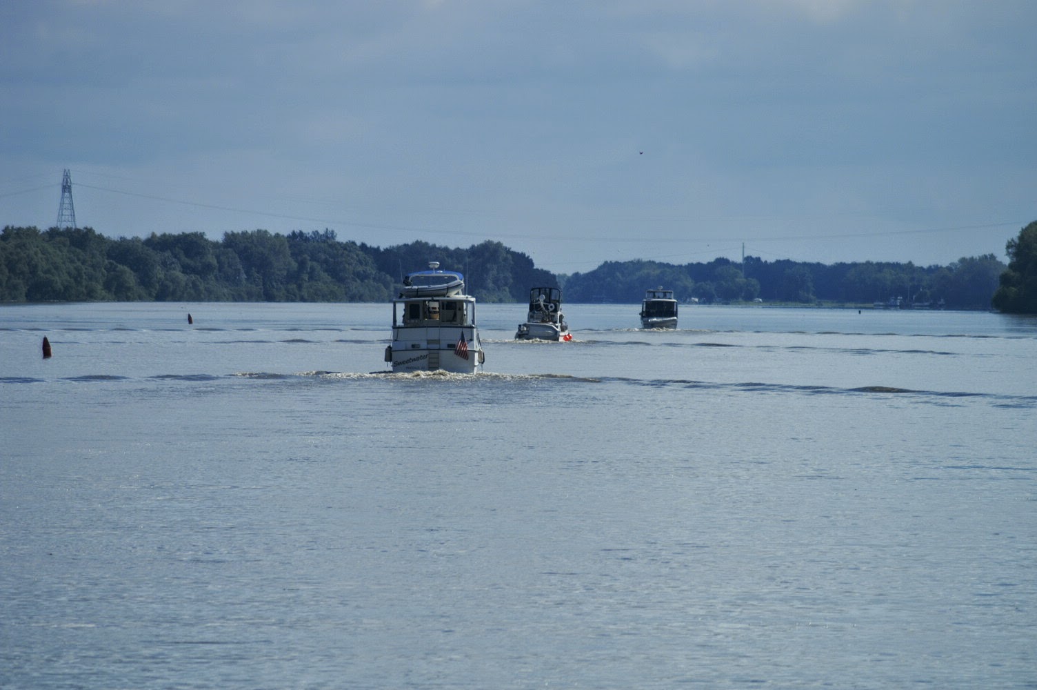
     Well, today is my (71st) Birthday! While I slept in, Terry took some fellow Loopers to the grocery store. The marina has been full every night although each day 1 or 2 boats has moved on down the river to other marinas where they had reservations, but each evening new boats came in to take their place. On any one day there were at 6 Loopers docked here so this is a busy time for these smallish local marinas.
     We went out for lunch at El Camino Real Restaurant along with stops at Walgreen's and Dairy Queen. At DQ I had their largest caramel sundae! On the way back to Tall Timbers we dropped off the rental car at Canton, and they returned us to the marina. Before dinner, I had a Face Time call from the Grandkids who were very excited to say the least! After dinner, the celebration continued with everyone having three pieces of a different type of cheese cake. Wow! If that doesn't put you to sleep, I do not know what will...
Thanks to the Admiral and Jim I had a wonderful birthday!
     Anyway, an early bed time was a good idea since we plan to leave early tomorrow and have a trip of about 100 miles planned, which will make for a long day.

Friday, September 19, 2014

Day 2-304 to Tall Timbers Marina in Havana, IL

     Well, we may not have gotten much rain yesterday, but further downstream, the Missouri River as it enters the Mississippi River is flooded. Some areas in the lower Missouri had 6 inches of rain in one 24 hour period. The Illinois River is also near flood stage, and since the Illinois and Missouri Rivers flow into the Mississippi within 15 miles of each other, this has created some lock closures and LOTS of debris on all of the river. Thus, the down river marinas are full of Loopers who are "stuck" there waiting for the flood waters to recede. Therefore, when we headed to Havana, we knew in advance that we might be there a few days waiting for the flood waters to recede downstream.
     Our trip today was 48.1 miles, and it included the Peoria Lock with a drop of 11 feet and 8 bridges. As we approached the Peoria Lock, we passed under the Shade-Lonman Twin Bridges with the Peoria Lock just visible under the lower left side of the central spans of the bridges (picture at right). You may have noticed that I have not mentioned the dam associated with this lock. The dam is a "wicket dam", which means that the dam can be rotated about hinges at the upstream  (or bottom) end of the dam. Since we are near flood stage for this lock, the dam has been lowered and we will pass right over the dam and not need to use the lock.
     Yup, the tow on the right side of the picture above is headed toward us in the upstream direction, and it has just crossed the wicket dam. The picture on the left shows the lock on the left half with several work barges in the lock chamber. On the right hand side of the picture is a lift gate. The wicket dam is to the right of the picture. In this case there were about 8 individual wickets that are raised up to block (or dam up) the water. As you might imagine, the first few wickets are easy to raise, but as the flow is restricted and water begins to rise, the remaining wickets are harder to raise. To make this process easier, the lift gate on the right side of the picture is the last part of the dam to close.
     The picture at the right shows Lucky Us about to pass over the wicket dam. You are now looking at the side of the lift gate in the previous photo, and the lock is in the background. It was such an interesting (or exciting?) event that I forgot to look at the depth sounder as we passed over the wickets... Anyway, we had slowed down, but it was certainly faster than going through the lock would have been.

     The picture on the left was taken a few seconds after the one above, and it shows the view out the other side. In this view the wickets the wickets would rotate up from left to right (upstream) and fill in the river up to the concrete wall. After the wicket dam, we had only two more bridges in 4.8 and 6.7 miles. By then we were past the City of Peoria and has passed under 8 bridges in 14.5 miles, which is not a large number of bridges for a "real" city.

     Once we had passed under that last bridge, we could pretty much enjoy the ride on the fast flowing (current about 2.2 mph) Illinois River for the remaining 31 miles of today's trip. There was debris in the river, but fortunately, most of it was small branches with very few tree trunks to worry about. 
     We arrived at Tall Timbers Marina in Havana, Illinois a little after Noon, and we walked about 4 blocks to have lunch at Trixie's Cafe.  After lunch, we stopped at Ace Hardware to buy some stainless steel hose clamps (6) and 2 feet of 5/8 inch inside diameter black (radiator?) hose for the diesel engines. When I started my generator repair project, the first thing to check was for a blocked/clogged PCV valve. So, in the process of doing that check for the generator, I also cleaned the PCV valves on the main engines and replaced several worn and cracked hoses and clamps. Of course, the hoses were a total of 3 different sizes (3/8, 1/2 and 5/8 inches, inside diameter). We had the big and little hoses in our trusty spare engine parts box. So, with the new hose and more clamps, I was quickly able to finish replacing the last of the hoses. The picture at the right shows the cracking through the original red (main engines) and white (generator) paint. At the bottom end of the top hose you can even see where a piece of the hose is missing.
       Then it was time for naps for everyone...

Day 2-303 waiting for the rain in Peoria...

     The weather predictions for today called for rain and thunderstorms for most of the day so we decided to stay at the dock for another day. As with many predictions, we had intermittent showers but nothing bad.
      I spent some time in the engine room and managed to install the new fuel pump on the generator (picture at right). I still have to change the oil on another day. There is a black arm sticking out the right side of the pump. The arm is pushed up and down by a cam (lobe) on the crankshaft. The arm pushes a rubber diaphragm inside the pump in/out to pump the fuel. The thought (hope) is that the diaphragm was bad and caused the motor oil in the crankcase to leak into the fuel inside the pump. The generator was due for an oil change, but with the leaking fuel pump there was about 2 quarts of diesel fuel mixed in with the motor oil. This is sort of a "work in progress", but the temperatures have been in the 50 -65F range lately. Thus, if we end up anchoring out for a night, we would not need to run the generator for the air conditioning. So, I will wait for another "rain" day to change the oil and test the pump. The fact that I would spend an entire paragraph describing this job may tell you something about how exciting a day we were having.
     The weather prediction for tomorrow is much better so we will probably head out in the morning with a destination of Havana, Illinois. At our normal cruising speed of 8.3 mph plus 2 mph of current, it will be a fairly short trip of 48.1 miles tomorrow.
     RARE EVENT... I did not make a conscious decision to do this, but I spent the entire day on the boat at the dock. If you are anchoring out it is easy to spend a whole day on the boat, but in addition to being busy, staying on the boat is also a testament to the dreary weather all day.

Thursday, September 18, 2014

Day 2-302 Onward to Peoria, IL

     We departed the Starved Rock Marina at 8:15 am and headed down the Illinois River to the north side of Peoria, Illinois. Our trip was 65.0 miles and about 2.1 miles later we arrived at the Starved Rock Lock. We passed through the lock with 5 other Loop boats (picture at right). In the picture we had just passed under the Utica Bridge, and if it looks kind of like a race, it was. Well, sort of a race since we happened to be the first boat out of the lock, and we were the slowest boat. I did managed to "teach" several of them what a slow pass is. When a boat approaches from behind and calls to ask for a slow pass. the lead boat slows down and the following boat also slows but not quite as much. They then glide past and accelerate once clear. As the other boat passes, I turn to get behind the other boat (and inside their wake). Once past, both boats can then accelerate and neither boat has been rocked by a large wake. It only takes a minute when done well, and several boaters thanked me for the learning experience. The Admiral did note that two boats did not call, and instead they passed us at cruising speed giving us a rock and roll trip through their wake. Go figure? What does a 1 minute slow down really hurt? Oh well...
    In another mile we passed the Starved Rock State Park, and as we passed the landing at the park, we say the (replica) steamboat Spirit of Peoria leaving to head back down river to Peoria. The boat comes from Peoria in a day trip and the passengers stay overnight at cabins in the park. The boat had just left at 9:00 am for the return trip to Peoria. It was quite a sight, and we followed her for about 30 miles, which made for an enjoyable trip watching the paddle wheel churn up the water until we reached our planned destination in Henry, IL. We had a reservation at the Landings at Henry Harbor on the north side of quaint old town of Henry. Since the water level in the river was low, they could only accommodate us on the wall of an old, abandoned lock. We tried it out, but we decided not to stay there. The setting was pretty inside the old lock, but we would had had to tied the boat to trees about 15 feet from the water. Also, the power poles were 15 feet or more back from the walls of the old lock. Normally, we hook up two 30 amp power cords, but with this distance we would have had to put our two cables together end to end to reach one outlet. So, I made the decision that we would move and find another marina down river. Once again, it was the Admiral to the rescue as she got us a dock at the National Marina on the north side of Peoria. It added something like 28 miles to our trip. However, we were making very good time thanks to a down stream current of about 2 mph.
    We passed one small town where we saw a small tug race out and pull up alongside a large tow. We could see people on both boats handling boxes of groceries. Later we heard the small tug call another tow and tell him that he was ready to pull along side to deliver groceries. Anyway, it was pretty cool to watch the tug get resupplied on the go.

     We have been seeing more White Pelicans as we progress down the Illinois River. White Pelicans spend the summers in Minnesota and Wisconsin (as well a Canada) and fly south for the winter. When they are swimming, they appear all white, but they have black wing tips and black on the underside of the wings that are visible in flight. This particular flock seems almost like they were practicing forming a "V". So, perhaps they were getting ready to migrate south (?).


     After docking, we walked about a half mile to a "classic" burger joint that was also hosting a trivia night. Although the day had been beautiful, by that time it started to mist a bit. In spite of the drizzle, the burgers and trivia were kind of a fun way to end another lovely day on the water.

Wednesday, September 17, 2014

Day 2-301 Wilmington to Ottawa, IL

     We left Harborside Marina in Wilmington at 8:00 am and meet up other Loopers who were waiting for the first lock of the Day. Our destination was Ottawa, Illinois, which was a trip of only 39.9 miles. The picture at the right shows Harborside Marina early in the morning just before we left.


      It was only 2.3 miles to the Dresden Island Lock where we met up with 5 other Loopers who were waiting for a tow to lock through (picture at left). It was also our first experience with a boat that just had to be the "first" boat into the lock... On the brighter side, it was our first experience rafting alongside another boat inside a lock. They had a limited number of floating bollards, and the lockmaster wanted all boats to be tied to a bollard or rafted to a boat that was.
     The picture at the right shows three boats rafted together in front of Lucky Us. On the port (left) side of Lucky Us, we are rafted to Grand Finale who in turn is tied to a floating bollard. It was a great "first time" for rafting inside a lock since there was no wind and virtually no turbulence as the water was let out to lower us 22 feet.
     A little over 26 miles later we entered the second and final lock of the day. This time we were able to return the favor and let Grand Final raft alongside Lucky Us (picture at left). It turns out that boats have the right to refuse to let someone raft onto them. Fortunately, we were with a very agreeable bunch of boaters since once again the Lockmaster insisted that all boats be tied to a floating bollard.

     In the hierarchy of locking, it turns out that tows with non-hazardous cargo have the right to refuse to have pleasure craft lock through with them. If they have a hazardous cargo, the rules are clear, and no pleasure craft are allowed in the lock with them. In this lock there was a Corps of Engineers barge and tug, and the Captain was kind enough to allow pleasure craft in with his tow. This is the same lock (Marseilles Lock) as in the picture above so grand Final is rafted to Lucky Us just outside the picture to the right (or starboard side). In this lock we went down a little over 29 feet, and after this lock we proceeded to Ottawa, Illinois, which was our final destination for the day. We had planned to stay on the free wall in downtown Ottawa, but it looked pretty full as we approached so we decided to head on down river. Kudos to the Admiral since she was able to get us into the Starved Rock Marina just 4 miles south of Ottawa.
     I will close with a pretty picture of the Illinois River taken late in the day. I seem to have spent most of this post talking about locks, but as you can see, the river is quite pretty, especially with the higher bluffs near Ottawa.

Monday, September 15, 2014

Day 2-300 (sadly) leaving Chicago to head south on the river system

     Sadly, after 12 days (11 nights) in Chicago, it is time to head south on the Chicago River and points beyond... The Admiral took this last picture of a sunrise over Lake Michigan just before she woke me up. We (the Admiral, her Father (Jim) and I) left the dock at 7:00 am, and after a brief stop to pump out the holding tank, we cleared the marina about 7:20 am. Our trip was a long 55.5 miles, including three locks. In addition, we passed under a (whopping) 62 bridges plus one Amtrak bridge that had to open for us. Of course, the majority (43) of these bridges were in the first 17 miles.
     On our short trip to the lock at the Chicago River we did get some beautiful views of downtown Chicago with the (very) early morning sun reflecting off of the buildings and then off of the water back to us. The views (see a sample in the picture at the left) were so spectacular that I was almost happy to be awake this early.
     As we entered the lock between Lake Michigan and the Chicago River, we continued to see the beautiful views of sunlight reflecting off the buildings onto the water and back to us. This was our third time to enter this lock (picture at right), and the sun angles were very different each time, which also made each trip different.
     Since this is our third trip through the first 19 bridges, I will spare you any more pictures of downtown Chicago. Once we were into new territory past that nineteenth bridge, we were essentially out of downtown Chicago. The character of the town and in particular, the water front changed dramatically. We passed hundreds of barges with sand, gravel and (dry) cement. These are the basic components for cement used in building and highway construction, and in the case of Chicago, it is brought in by barge. The Chicago River was narrow enough that we had to wait several times for tows each with barges two wide to pass each other. Then we would have to hurry to pass the tow headed in our direction before it passed another tow headed in the other direction. Even though today was a Sunday, the traffic was fairly heavy as they were staging empty barges for later transport back down river.
     One of the more "interesting" parts of today's trip was passing through an electronic fish barrier that was installed to prevent Asian Carp from reaching Lake Michigan. The barrier was designed and installed by the Corps of Engineers to prevent this invasive species from ultimately getting into all of the Great Lakes. The barrier is about 0.6 miles long and has undergone a lot of changes and refinements over the past 3 years. For a while the river was just flat out closed. Then it was opened for short periods of time to allow carefully guarded boats to past through the barrier. Now, the voltage is low enough to not harm boats, but swimming, fishing, etc. is prohibited. There is still the possibility that the river might still be permanently closed to prevent the carp and/or future invasive species from entering the Great Lakes. Imagine being able to do all of the Great Loop on the water, except for having your boat transported 0.6 miles by trailer...
     Inside the last two (of 3) locks for today, we had our first floating bollards of the entire trip. All of the previous locks either had lines hanging down the wall of the lock to grab onto or rods inside a recessed cavity in the lock wall to which you could wrap a line around. In the picture at the right Terry is holding onto a line that is attached to the floating bollard, which looks like a (rusty) vertical pipe with a mushroom on top. If all goes well, the bollard floats up/down with the boat as the water level changes. The reason that Terry is holding on to the line is that in the event that the bollard gets stuck, you must be able to let out line to allow the boat to continue up/down. So, while floating bollards sound like a nice convenience they are not fool proof.
      Since we are now in "barge country" where there will be a lot more barge traffic, both the tows and the locks will progressively get larger. At the moment, the tows are limited to 8 barges consisting of four pairs of side by side barges. For scale, the picture at the left shows Grand Finale, who was a travelling companion today, across and about halfway down one of the locks today. She is 40' long but is dwarfed by the bigger lock, and since the locks are larger, it takes longer for them to empty/fill. Thus our transit times for each lock will go up. By the southern portion of the Mississippi River, the tows can be as large as 72 barges with two tugs pushing them. We are not going all of the way down the Mississippi River so I think that the largest tows that we will pass will be 15 barges (5 long by 3 wide).
      We reached our final destination the Harborside Marina in Wilmington, IL after a long day of nearly 11 hours. Needless to say, we all slept very well, but not before we had this lovely view of the Moon shinning on the Illinois River.