We departed the Galveston Yacht Basin at about 7:00 am in 15-18 mph winds with gust of 25+ out of the northeast. Our trip to League City was 28.7 miles with about 2/3 of that in the Houston Ship Channel. These conditions are within our comfort zone, but in retrospect, we should have waited until later in the afternoon when the winds had died down to about 5-8 mph. However, hind sight is always 20/20. The ship channel at Galveston runs east-west between Galveston Island and Pelican Island to the north. Thus, we had been underway about 15 minutes before we rounded the corner of Pelican Island and could feel the true effect of the wind. The AIS had at least 30 vessels plotted in our general area. Fortunately, at least half of those were tows "parked" along the GICW waiting for the winds to die down before they headed up the ship channel to Houston. It takes about another half hour to pass the GICW crossing and the turn off to Texas City. At that point all of the turning and cross traffic is behind you, and we could settle into the routine of staying out of the way of the commercial traffic in the Houston Ship Channel.

We passed three ships coming toward us in the sip channel as well as about 6 tows. That is the easy part since on a clear day, you can see them coming for many miles and have plenty of time to move over to the side of the channel. The picture at the right shows the Ocean Aquarious about to pass as she heads out the ship channel. I said that you have plenty of warning with approaching ships, but I did not say that one is ever prepared for how big they are or how fast they are going. In this case we were closing at about 30 mph...
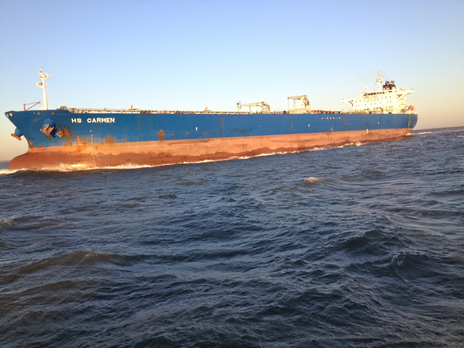
The picture at the left shows the outbound HS Carmen about to pass. Both of these pictures give you a good idea of the waves. Although we were inside the channel markers, we were pretty much at the red markers on the east or in bound side. Generally, we record about 26 feet of water in the channel, but along the sides it gets shallow very quickly. I'm not sure what the average depth of Galveston Bay is, but we rarely see more than about 12 feet of depth minus 4 feet for our draft. So, with shallow water the waves cannot get very high, but they can be steep and close together.

Okay, so ships and tows coming toward you are easy to see in clear day light, but as the skipper, I need to keep a lookout for ships coming up astern of us. This is a necessity since they are closing from behind at over 25 mph and can "sneak" up on you if you are not careful... Fortunately, the Admiral is much better at checking astern than I am, which helps a lot. The picture at the right shows the Nordic Ann about to pass us. She is going into the wind, and you can see the spray flying in continuous sheets 15 to 20 feet in the air.

There are a number of places where we could leave the ship channel and head for the entrance to Clear Lake at Kemah, Texas. We chose to say in the ship channel until we could turn and have the wind almost directly from the stern. After the turn, we noticed that the dingy had partially torn loose and was about to fall off its davit on the swim platform. We slowed down and were able to pull her partially back on board (picture at left), and thanks to the Admiral we secured her with several dock lines. Not a perfect fix, but it was good enough until we reached our dock. The photo may look strange since it was taken from the flybridge looking down at the dingy.

Earlier we had heard an announcement by the Coast Guard that the Lakewood Yacht Club was having sailboat races just off the Kemah Channel starting at 10:00 am. So, we wove our way through about 40 sailboats as we headed into the Kemah Channel. Fortunately we made it into the channel before the racing started (picture at right). There is a power boat headed out the channel, and in the background you can see some of the amusement park, including the roller coaster (at left) and several rides that go in loops or drop you from tall towers. On the far right there is a sailboat just exiting the channel that connects Galveston Bay to Clear Lake.

Our destination is at the far (western) end of Clear Lake about 4 miles from the spot where this picture was taken. Most of Clear Lake seems to be no more than 6 feet deep so we need to stay in the marked channel if we want to speed up to normal cruising speed. The picture at the left shows our view as we turned into the channel to South Shore Harbor. Yup, it is definitely not a great picture since we were headed right into the Sun, BUT at this point we could see our town house on the left and the lighthouse on the right which we can see from any of 4 rooms on the back side of the town house.
Pretty soon we were opposite our town house, and the slip for Lucky Us is just out of the view to the right.
To be honest, the next little while was all a blur as we docked and walked the short distance to the town house.
Yes, it was a great feeling to be home, but...
Anyway, here is the final picture (at left), and it shows Lucky Us sitting happily in her slip probably wondering where we are going to take her next???


No comments:
Post a Comment