Wednesday, July 9, 2014

Day 2-240 short but windy trip to Buffalo, NY

We left the canal wall in Tonawanda at 8:15 am in clear skies with a strong southwest wind of 15-20 mph. After about 2 miles, the Erie Canal ended as we entered the Niagara River and headed upstream toward Buffalo, NY. At this location the Niagara River is split as it flows around Grand Island. We were in the eastern part where the current is lowest, and I estimated the current at 1.5 mph based on engine rpm and boat speed over the ground. At the southern end of Grand Island the river comes back together, but it is very wide, which also keeps the current low.
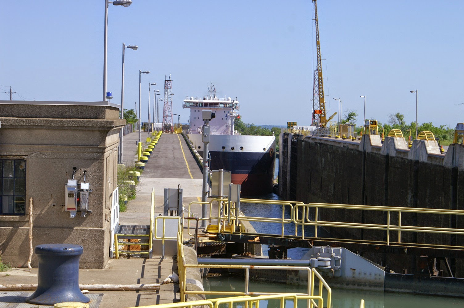
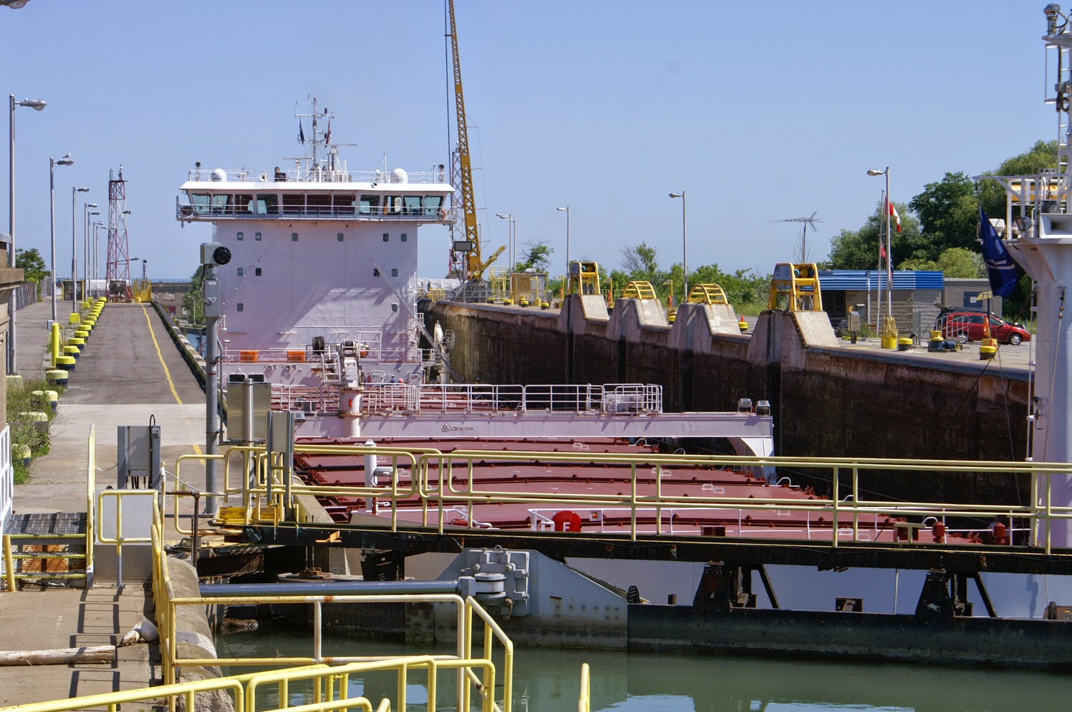
As you approach Buffalo and Lake Erie, the river becomes narrower, and the current goes way up. The current is strong enough that some commercial vessels, like barges, and some slower pleasure craft like sailboats and trawlers, like Lucky Us, would have difficulty going against the current. The US Corps of Engineers built the Black Rock Canal along the eastern shore. The canal has one lock at the eastern or downstream end that effectively reduces the current to almost zero. The picture at the left shows Lucky Us about to enter the lock at the start of the Black Rock Canal.

The lock raised us over 5 feet, which effectively removes the gradient (slope?) of the river between the lock and the other end of the canal. After exiting the lock, there was a railroad swing bridge about 0.2 miles ahead. Later, we also passed through this bascule bridge over the canal. In the background you can see the Peace Bridge between Canada (right) and the US (left).

We passed a school for crew (rowing) and there were two young crews practicing carrying the shells overhead and then lowering them into the water. I bet that there will be some very sore young men and women tomorrow...


Later we passed under the Peace Bridge, which we had crossed in our rental car while returning from Canada on Day 2-236. We are still in the Black Rock Canal with the mainland on the left and an artificial rock bulkhead on the right. It was interesting to look to the far right and see the Niagara River flowing swiftly past us while we were in the quiet, almost still water in the canal. The canal ends at the start of the Buffalo Harbor so we were protected from the current in the canal, and in the harbor the breakwater protected us from the 3 to 4 foot waves out on Lake Erie.

We arrived at the Erie Basin Marina near downtown Buffalo about 11:15 am. A slow but pretty 13.1 mile trip. The weather forecast had been for afternoon showers and thunderstorms starting about Noon, and right at Noon we saw the first black clouds passing to the north of us. I am writing this at about 8:30 pm, and the black clouds are still passing just to the north of us. Please excuse me for a minute while I go knock on some wood...
On our way to dinner we walked around some of the harbor side area to view the sights. There is a Naval Museum with a submarine, destroyer and a cruiser. They also had a number of land based exhibits like a submarine conning tower off a sister ship to the USS Buffalo, which is still in service.


We also saw this "classic" lighthouse in the outer harbor. Sorry, but it just sat there calling to me to take its picture.


We ate dinner at a large waterfront restaurant located at the end our marina. Here is a picture of me with the marina in the background. As we were eating dinner, we watched several sailboats leave the marina to join a growing fleet of sailboats in the outer harbor. Today is Wednesday so it probably was a mid week race that is part of a summer long series.


I will end today with a picture of the fleet during pre-start maneuvering. It was really a pretty sight.

As I said yesterday, the weather predictions for the next four (?) days are pretty good so we hope to leave early in the morning for Erie, PA, which is a trip of about 81.1 miles or about 10 hours.

Tuesday, July 8, 2014

Days 2-237-239 Rain & wind delay in Tonawanda, NY

He had planned on a multi day stay in Tonawanda, NY for the Fourth of July and visits to Niagara Falls and the Welland Canal. However, For the past three days we have been forced to extend our stay at the dock due to high winds, heavy rain or thunderstorms (and sometimes all three). The storms that passed through this afternoon and evening were headed east at about 55 mph and had wind gusts reported as high as 30 mph. As usual, we have managed to keep busy with the seemingly never ending projects on Lucky Us. In addition, the Admiral has gotten daily exercise riding her bike to a lumber store, hardware store and Home Depot. The accessibility via bikes is very good in Tonawanda, especially with the trail along the Erie Canal taking her halfway to Home Depot, which was the furthest away.

Yesterday, we did take Lucky Us on a VERY short cruise of 200 yards to the other end of the dock wall for a much needed pump out. The canal wall has remained full after the weekend, which was surprising. We had thought that most of the boats that had arrived over the Fourth of July weekend would have gone back home on Sunday evening. However, the Dock Master explained that people leave their boats here all week in order to guarantee a good spot for "Canal Week" that starts on Friday evening and runs for 9 full days.

The weather forecasts are now improving starting in two days. So, we now have a (tentative) plan for heading west on Lake Erie. We hope to leave tomorrow morning to head out the Niagara River and into the Port of Buffalo. Meanwhile, out on Lake Erie the waves are supposed to be subsiding from 4 to 2 feet. It is only a 12 mile trip that we have planned for tomorrow, and most of the trip will be in protected waters and not out in the big lake. However, part of the trip is bucking the current in the Niagara River for 2 miles. Then the rest of the trip is in the Black Rock Canal, which is along the east side of the Niagara River. It has one lock and was designed to bypass a stretch of the Niagara River where it is narrow with a strong current. All of these factors mean that the 12 mile trip will take about 3+ hours with luck. The "luck" includes properly timing the opening of the lock, which happens only once per hour. The bottom line is that once at the waterfront marina in Buffalo we will only be about a mile from where the main channel out of the harbor enters Lake Erie. So in essence, we are staging the location of the boat for what will be a fairly long 80+ mile trip to Erie, PA. The weather is supposed to quiet down to 5-8 mph winds and waves less than 1 foot. If that happens, we will be headed west on Day 2-241.

As always, stay tuned...
 

Sunday, July 6, 2014

Day 2-236 car trip to the Welland Canal in Canada


We extended the rent car for an extra day to go into Canada. After crossing the US-Canada boarder, our first destination was the Welland Canal. The Welland is the lock system for large ocean and lake freighters passing between Lakes Ontario and Erie. The elevation difference between the two lakes is about 326 feet, and this rise/fall between the two lakes is accomplished via 8 locks. The Welland Canal is also used by pleasure craft, especially ones that are too tall for the western Erie Canal. We have done 50 locks on the Erie (and Oswego) Canal, and we were a little curious what it would feel like looking into a really large lock. We started at Lock 7, which had very good viewing angles. The first photo (above right) shows a 700+ foot lake freighter entering the lock from the Lake Ontario (down) side.
The entry/exit is quite slow since many of the ships are only 2 feet narrower than the lock by design. Yes, I was impressed by the size, but at the same time I thought that everything about the lock also looked familiar. I really do not think that we would be intimidated by the thought of going through these locks. Now, all we have to do is win the lottery so that we can get a boat where we would have to go through here  ha, ha. The second photo shows the freighter all of the way into the lock. Once the boat is securely tied up, the lock gate is closed behind the ship.
I did not time it, but it seemed like only about 10 or 15 minutes elapsed before the ship was all of the way up and ready to exit the lock. The picture at the right shows the freighter all of the way up and the gate to the lock is open. Just like the entry, the ship moved very slowly out of the lock.


The picture at the left shows the lock empty, full of water and gate open as the ship has just exited. The lock is now ready for a ship going in the other direction to enter and go down.


As the ship exits, the walls on either side open away from the lock. Thus, as the channel gradually widens the ship can pick up speed, and in this case the ship has one more lock to pass through before it enters Lake Erie.
     I suppose that it is for security after 9-11, but most of the parking lots for observation at the locks have been fenced off and are no longer accessible. There was one large information, viewing center with a museum, but otherwise, I was disappointed that we could not see more at the other locks.
There was a small information center adjacent to this lock, and just outside is.... Kissing Rock. Well, you are supposed to sit on the rock and kiss. I will leave it to your imagination as to whether or not the Admiral and I did that.


We had a lovely lunch at a Panini restaurant in the small town next to the lock. I had a roast beef sandwich instead of a Panini (always a rebel).


After lunch, we drove along the canal toward Lock 1 and Lake Ontario. Then we drove a short distance along the lake toward the Niagara River. The city of Niagara-on-the-Lake is located at the junction of the Niagara River and Lake Ontario. It is a beautiful old town, but the downtown area was so crowded that we did not stop to walk around the many shops. Instead, we drove along the Niagara Parkway, which follows along the Canadian side of the river. We went up river past Niagara Falls and toward Lake Erie. The Admiral said that it would be fun to come back some other time and ride the bike trail. I told her that I would meet her at the other end...

 Just before we reached the lake we crossed the Peace Bridge across the river and back into the US. This was a beautiful drive, and there is also a wonderful bike/pedestrian path as well. While driving along the lake and the river, we passed one small winery after another. Almost all of them had elaborate facilities for wine tasting, parties, etc.

Day 2-235 Happy Birthday America!

We planned to stay on the canal wall in Tonawanda, NY for a few days, including the 4th of July (today), and then we are looking for a weather window to head west on Lake Erie. We celebrated in a rather low key manner with lunch out at "Cheeburger Cheeburger". No, that is not a typo. The place sounded better than it was.... They have over 1.2 million options on their milkshakes and many options on their burgers, but what really surprised me was the number of options on the salads. Anyway, I had a patriotic red-white-blue shake and a mixed green salad with a veggie burger and options on the salad like dried cranberries, feta cheese, nuts, etc.

We also went to see "22 Jump Street" again. It was even better the second time. I guess that I was more prepared for the language, and I picked up more of the subtle humor. The movie theater has the greatest seats (picture at right). They are really wide and fully reclining with push button control. Even with the seats fully reclined, there was still plenty of room for other people to pass in front. As you can see I got my full dose of popcorn!

We had on our patriotic red, white and blue shirts, which are actually a Texas state flag pattern.

Back at the boat we enjoyed the parade of power boats, kayaks, canoes and peddle powered catamarans (picture at left). The activity was never ending. There was a 10 to 15 mph wind blowing down the channel. Many people started out down wind, and then they found out too late that it was much more difficult going up wind and up current.

We saw an excellent fireworks show at 10:00 pm. It was about a mile away, and most of the fireworks appeared to the upper left of the tall building across the canal.
The rafting of boats continued today as it was quite crowded at times. The Admiral snapped this picture (at right) of 5 boats rafted together on the canal wall. Given the wind and slight current, they did pretty well.

Hope you all had a happy and safe Fourth of July!

Saturday, July 5, 2014

Day 2-234 in Tonawanda, NY -car trip to Niagara Falls

The Admiral arranged for a two day car rental starting this morning (July 3, 2014), and we plan on a trip to Niagara Falls. During her walk this morning, the Admiral took the picture at the right of two boats the we had travelled with on/off for the past three days. The green boat trailing the dingy and the white boat at the far left are both staying on the wall in Tonawanda near us. I guess that it was unusual enough to see three larger boats travelling on the western Erie Canal that we were featured in the daily blog for Orleans County, NY (click on link below):
http://www.orleanshub.com/news2014/Nice-way-to-beat-the-heat.htm
First, a few numbers to help put things in perspective. Lake Erie is about 325 feet higher than Lake Ontario. That drop is accomplished along the Niagara River, which is about 36 miles long. About half of that drop (170 feet) occurs at Niagara Falls.
...and now to cut to the chase. We headed out in the rent car about 10:00 am, and when we arrived in Niagara Falls, we went directly to the Maid of the Mist tour boats. We have both been to the falls before (I've been to both the American and Canadian sides and Terry to only the Canadian side), but for me, the most impressive part is the boat trip in the turbulent waters while getting soaked by the mist from the falls. The picture at the left shows us after putting on our rain gear that was provided by the tour company. We were soon to put up the hoods and tie them securely once we left the dock.
We took many pictures, but I will only bore you with a few of them. Down in the canyon below the falls the noise is impressive. You can literally feel vibrations in the air, and the mist is everywhere. To me as a geologist, I have always been impressed by the power of nature, and this is an excellent place to experience that power. The picture at the right shows part of the American Falls, which are smaller and less impressive than the Horseshoe or Canadian Falls. The resistant vertical cliffs at the top are the Lockport Dolomite.

The underlying rocks are mainly shale, and as such, they are much more easily eroded than the dolomite. The shale erodes back leaving an overhanging cliff of the dolomite. The overhanging rock will eventually fail and fall to the bottom of the waterfalls. This has happened twice in recent history with the most recent rock fall being 60 years ago in 1954. This "pile" of rocks at the base of the American Falls is what makes them less impressive. Some attempts have been made to remove the debris, including using dynamite to break up larger pieces, but most of the debris remains today.
At the right is a view of a small portion of the Canadian (or Horseshoe) Falls. The water falls pretty much all of the way to the water level below. Up close, like in this picture, there is so much spray that it is difficult to get a picture through all of the mist. However, you can get a good idea of why the Canadian Falls are considered the "best" or at the very least, the most photogenic. After the boat tour, we took the elevator back up to the top, and the first thing that we noticed was how quiet it was. Down below in the canyon it was very uniformly loud so that we did not notice how loud it was until we were back in the "quiet".


The last picture is of the American Falls on the left and part of the Canadian Falls in the background that was taken from a view point on land at the top of the falls. Once again, you can see that the water going over the American Falls only falls about halfway down before it begins to hit the debris from the previous rock falls.

You can also see two of the tour boats in the river below. They look pretty small by comparison...


We then headed off to the Hard Rock Café for a nice lunch. We then drove around a bit before heading back to Lucky Us. Later it was time to (you should have guessed this by now) to head out to a movie. We saw "Earth to Echo" and found it entertaining although probably geared to a much younger crowd.

Day 2-233 to Tonawanda, NY and the end of the Erie Canal

We opted for a long trip of 29.5 miles in order to get to Tonawanda, NY on Wednesday, July 2 before a waterfront concert that evening and then the Fourth of July on Friday. We had anticipated that the canal walls would be packed for both the concert and the fireworks. Sure enough the half mile of walls were nearly full when we arrived and boats continued to trickle in after we arrived. We were warned by the Dockmaster that there would be many boats rafting up for both events. Our plan is to be here for a few days, including renting a car to visit Niagara Falls. The scenery along the way included this classic wooden cruiser apparently slowly sinking bow first.
We also passed another classic wooden tour boat that was in much better shape. Many of the little towns have some sort of party/cruise boat. These have often been busy throughout the week with plenty of parties.

We also saw the "usual" large flocks of geese both in the water and catching bugs in the grass along the canal banks.


My vote for the "coolest" building of the day goes to this waterfront (former) warehouse built of native stone. The number of native stone structures continued to increase as we headed west toward the Niagara Escarpment.


We also saw three of these pirate ship playhouses along the canal today. Pretty neat playhouse, but obviously you need a large yard to hold one of these.


We first saw the Niagara Escarpment as we approached Lockport, NY. The caprock for the escarpment is the Lockport Dolomite. Geologic formations are often named for the geographic location of the type section where the rock unit was first described, which in this case was the town of Lockport.
The picture at left shows our first view (to the west) of the escarpment as we approached the town of Lockport. The rocks here dip (or slope) gently toward the west or away from you in the picture, and in this case the escarpment formed the eastern boundary of Lake Erie, and indeed, the Lockport Dolomite is the rock that forms Niagara Falls further to the north. The city of Lockport sits at the top of the escarpment where you can see several buildings and a bridge at street level.
There are two locks that form a flight of locks. In this case, the two locks share one common gate in the middle. These were our only two locks of the day, but they have an impressive total lift of just over 49 feet. The picture at right shows Lucky Us entering the first (lowest) lock. The gate at the far end is the gate that is common to the two locks. The first lock raised us up to the (black) water mark on the far gate. That gate then opened, and we went into the second lock and were raised all of the way up to the top of the common gate.
When we exited the second lock we were still well below the city of Lockport (remember the bridge in the previous photo. That bridge was at street level in the city and we went under that bridge. The canal exits the lock in a steep walled channel (picture at left) that has been cut down into the Lockport Dolomite. This is the last lock on the Erie Canal before we enter Lake Erie. Thus, the water level here is pretty much the same as the water level of Lake Erie. Now you can see how this resistant escarpment forms in essence what is a natural dam for the eastern end of Lake Erie. The Niagara River flows over the Niagara Falls at this same water level, and that mean that the river has cut down through the upper part of the Lockport Dolomite just like this man made channel.
We arrived in Tonawanda, NY about 12:30 pm, and luckily, we had no problem finding a place on the canal with sufficient power available. Typical of these town walls is that some areas have no power, some just a normal 20 amp household plug, and a few have two 30 amp plugs, which is what we need to power all of our "toys", including our two air conditioners. The first warm up band started about 6:00 pm, and as you can see in the picture at the right, the walls were pretty well full, and some boats were rafted up. We were a little concerned about the etiquette of rafting, since we did not want just some random boat to tie up to us and proceed to walk back and forth across our boat all night long... Our fears turned out to be unfounded since all of the rafted boats were tied up to friends.

This was the first of a summer long series of Wednesday night concerts. The actual concert was from about 8-10:00 pm, and by 11:00 pm about half of the boats had left for home so it got pretty quiet. We were both so tired that I am pretty sure that any noise would have gone unnoticed on Lucky Us. The picture at left shows the concert venue and part of the land based crowd. The picture is not very good since we did not walk down to that end of the wall until it was about dark...
I will close with what we could see from Lucky Us of a beautiful sunset.

I can hardly wait for the fireworks on the Fourth of July!

Tuesday, July 1, 2014

Day 2-232 to Middleport, NY in very strong winds

Around this part of the Erie Canal, it seems that the name of most every town ends with "port".
In the past three days we have stayed at Fairport, Brockport and now, Middleport, where we are spending the night on the town wall. Tomorrow we will pass through Gasport and Lockport on our way to North Tonawanda, NY, where the Erie Canal ends.

We did see a number of interesting sights today, such as this giant apple in Medina, NY. It is dedicated to New York fruit growers, and we did pass a lot of orchards today. This picture is actually looking back east and shows a line of dark clouds accompanying a cold front that had just passed us. After this line of clouds, the sky had only scattered clouds until we reached our final destination for today. The front also brought strong southwest winds of around 25 mph. Since we were headed generally west at about 7 mpg, this meant that the winds were effectively about 32 mph, which was not very comfortable. Fortunately, the Admiral had put up the front of the flybridge enclosure for protection from the wind and possible rain.
In the last several posts I have mentioned the large number of bridges that we have passed under. Today we passed a "bridge to nowhere"... The bridge itself appeared to be in good condition, but it really was not connected at this one end???


Another bridge oddity was when the canal was actually a (very short) bridge over a road. The road in the center of the picture at the right actually goes under the Erie Canal.

Okay, for all of the scientists and engineers out there... Lucky Us weighs about 44,000 pounds fully loaded. Were we in any danger of causing the bridge to collapse (and why or why not)?

Sorry, there is no prize for the first correct answer.


We reached our destination of Middleport, NY about 12:30 pm. We could have gone further, but the weather prediction was for possible afternoon thunderstorms along with the strong winds associated with the cold front. So, we decided to quit for the day while the weather was still good.

Middleport is doing a good job of being boater friendly. The wall mural in the picture at the left  reflects on some of the heritage of Middleport as a canal city. The city provides a free dock wall on both sides of the canal along with free electricity. This is quite a rare and generous deal. However, the sign did say that we could make a "donation" for these services by simply going to the police department office. I took the hint and went there and made a small "donation".
The next picture (on the right) was taken by the Admiral during a late afternoon stroll through the downtown. The stroll did not take long since the old downtown was only about  a block and a half long. As for the picture, I will let discretion be the better part of valor and not comment on the sign...


The last picture for today (at left) shows Lucky Us moored on the canal wall. Indeed, we are the only boat spending the night in this very nice little town.